We traveled to eastern Washington on November 28, the day after the Thanksgiving holiday, and left early in the morning to go to Palouse Falls State Park. We had our youngest son, Edward, along. He had never seen the park or the falls and we want to show him this amazing place.
We had hoped for better weather, but at least it was dry. The sun looked ready to appear on several occasions, but for the most part the weather was dull and gray and cold, though not cold enough that the falls were icy. We still have not seen them iced over.
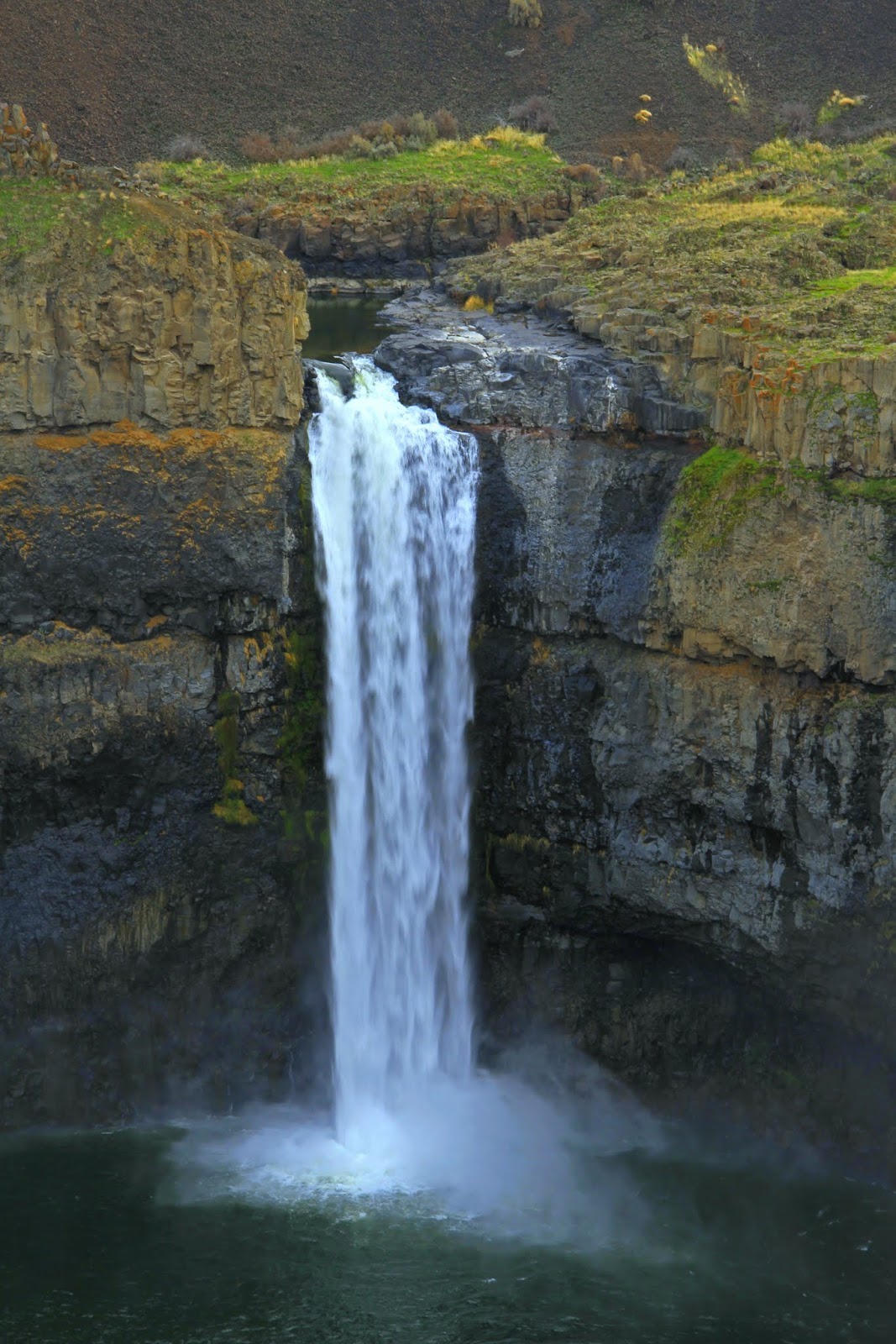
Palouse Falls State Park is located in southeastern Washington in the wheat-growing area known as the Palouse. A drive through this area of rolling hills to the park ends abruptly at a huge, 377 foot (115 m) deep hole in the ground into which the Palouse River drops 180 feet (55 m).
The canyon and falls are believed to have been created thousands of years ago by what are known as the Missoula floods. The Palouse River flows through southeastern Washington for 167 miles to its confluence with the Snake River a few miles south of the falls.
We hiked along the edge of the canyon taking pictures of the Lower Falls and the canyon from the various viewpoints. There are ways down into the canyon but we had neither the time nor the will to attempt any of them. The climb down is somewhat dangerous.
From the car Edward and I hiked north along the rim of the canyon and then down to the Upper Falls, more a series of rapids than a falls. These are easily accessible but not as impressive as the Lower Falls, falling only 20 feet (6.1 m). They are about 1,000 feet (305 m) above the Lower Falls.
The most striking feature of this part of the park is a huge basalt butte known as the Mohawk, around the corner of which the river flows. It has its name from its resemblance to a Mohawk haircut. From the edge of the river this feature dominates the landscape.
sign
sunrise over the Palouse
Lower Falls
the canyon and the surrounding area
Upper Falls and the Mohawk from above
Upper Falls and the Mohawk
Palouse River above the falls
headed back up
Lower Falls
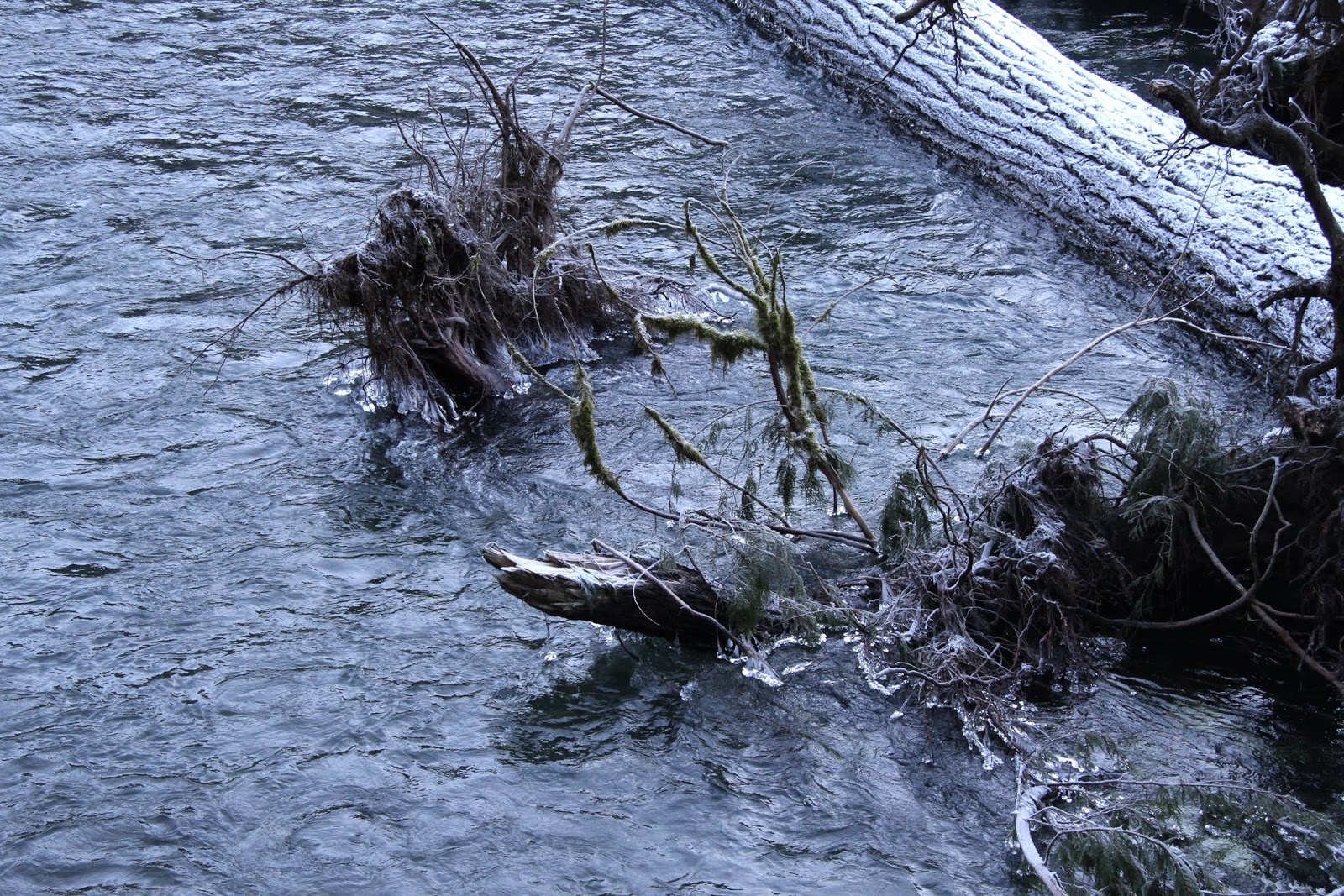
The Fingers
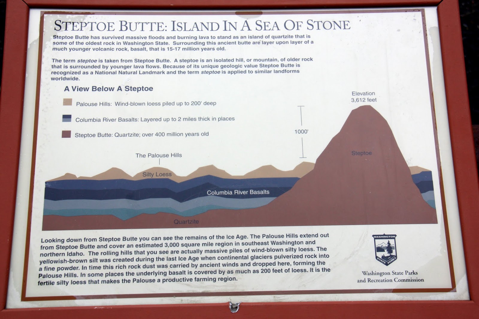
Finished with our brief stay at Palouse Falls we headed north for Spokane stopping at Steptoe Butte State Park on the way. Steptoe Butte is a massive island of quartzite that rises 1000 feet (304 m) above the surrounding countryside. The views from the top of the butte are impressive.
We did not spend much time there since the wind was blowing hard and it was cold, but did get pictures before heading on to our final destination. I used my camera for most of the pictures but did take a panoramic shot with my camera from the top.
Steptoe Butte
signs
views from the top
panorama