Showing posts with label palouse river. Show all posts

Monday, May 14, 2018

Lyon's Ferry


On May 12th we went to Palouse Falls State Park with our daughter and grandchildren, but found the park closed due the death of someone who had fallen from the cliffs and for whose body they were searching the river.  We went on to Lyon's Ferry State Park, a little south of Palouse Falls and spent some time exploring the area while the children swam and enjoyed ice cream and a picnic lunch.

Lyon's Ferry is named for the Lyon family which operated a ferry there until 1968 when the ferry was replaced by the Snake River Bridge.  The ferry is at the confluence of the Palouse and Snake Rivers and the area now has a marina and a fish hatchery as well as great views of the Joso Railroad Bridge.  We hiked the breakwater and enjoyed a beautiful sunny day there.

the old ferry

the views


Snake River Bridge


Snake River and Joso Bridges

Joso Railroad Bridge

Black Locust Trees


Dog Rose

Monday, January 29, 2018

Two Winter Trips to Palouse Falls State Park


"a way in the wilderness and rivers in the desert"

Palouse Falls State Park is favorite destination close to home. An hour an a half south of Spokane, Washington, it lies in the rolling hill country known as the Palouse, and area of wheat farms and long vistas. The main feature of the park is the falls for which the park is named, which drop 198 feet (60 meters) into a huge bowl in the ground. These falls, known as the lower falls, are on the Palouse River not far from its confluence with the Snake River.

Both above and below the main falls the river flows through a canyon which it has cut into the surrounding scablands. Upriver in the canyon the river makes an abrupt left turn around a huge granite outcrop known as the Mohawk and there is another falls there, really more of a cascade than a falls. This area is reached by a path along the surrounding cliffs to a railroad track and from there down a rocky slope to the river.

We were at the park early in January with one of our daughters, her husband and children. The park was very muddy and not only the children but adults were very muddy after a few hours there. The children enjoyed the mud, the adults did not. We were there again near the end of January with one of our sons who was out to help remodel our home. He was not dressed for hiking but we did make our way with him to the upper falls.

January 5


January 29


Thursday, February 23, 2017

Palouse Falls State Park


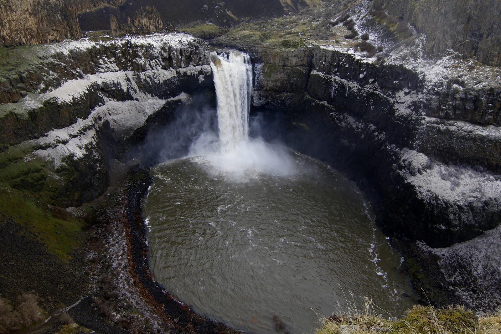
Palouse Falls has been designated the official falls of Washington State.  It is located in the southeastern part of the state between the towns of Washtucna and Starbuck.  The falls drop 198 feet (60 meters) into a huge bowl carved into the basalt formations by what geologists call the Missoula Floods.  The falls are on the Pallouse River and are part of a state park of the same name and though in a rather remote area can be very busy in the summer months.  There was almost no one there, however, when we visited, and the dirt road into the park was a muddy mess.

We arrived before sunrise and after waiting for it get light visited the cliffs above the falls near the parking area which offer some of the best views of the falls.  We had talked about climbing down to the base of the falls, but the trails still had considerable ice and snow on them and so we left that endeavor for another time.


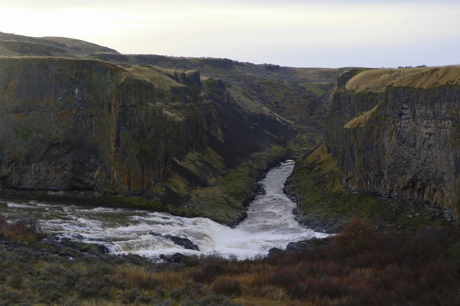
Finished in the main area of the park we hiked along the cliffs to the area of the upper falls, an area that the state park service does not recommend for hiking, and it was indeed quite muddy and the footing very poor where the descent was steep.  The upper falls are more a series of cascades than a real falls, but they were spectacular due to the amount of muddy water coming over them.

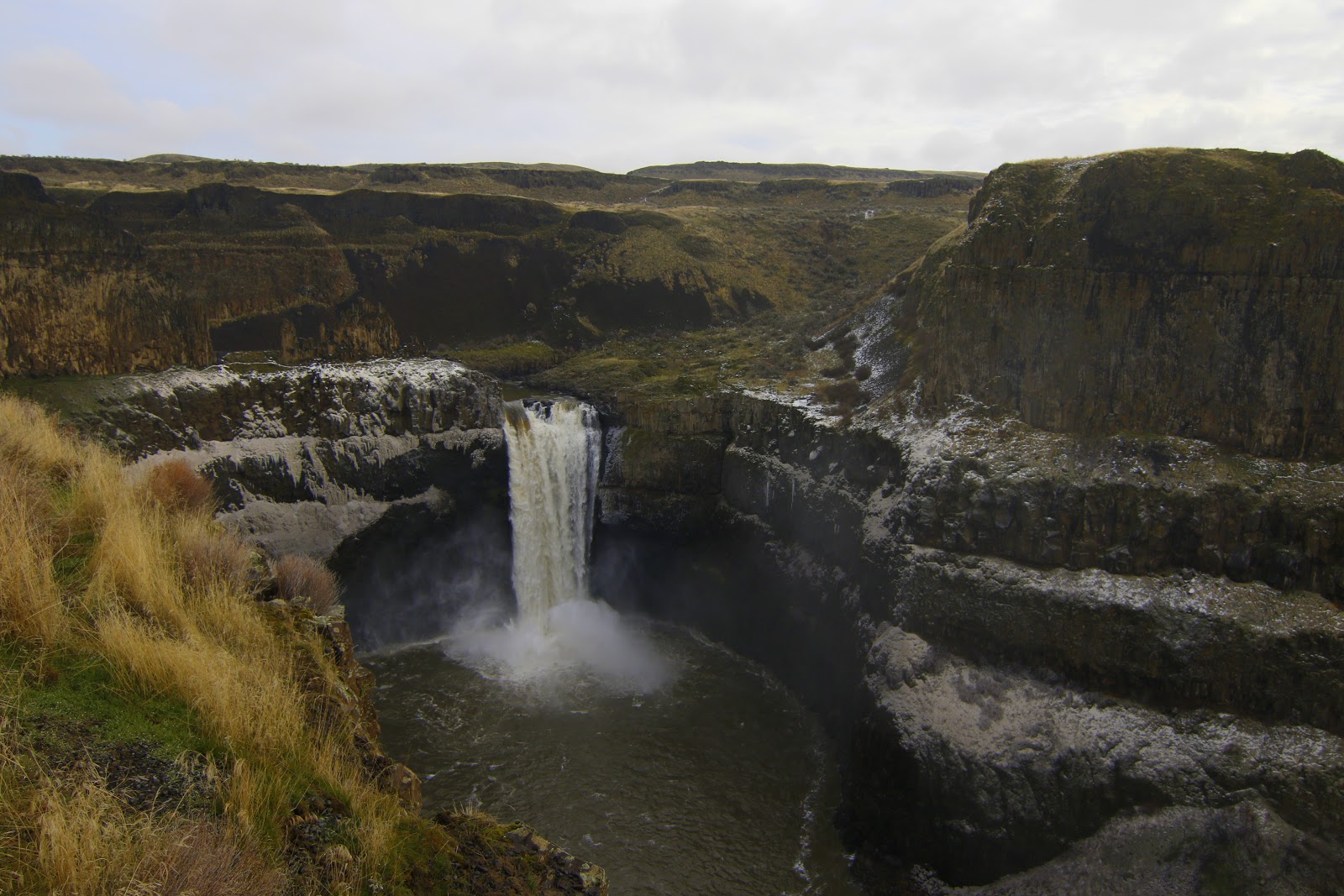
The area of the upper falls is known for the Mohawk, a huge flat-faced basalt formation in front of which and around which the river makes two nearly ninety degree turns before flowing to the much larger lower falls. After exploring the area we headed back up to the top of the cliffs and the parking area, taking photos along the way of the river and the top of the falls.


The cliffs are entirely unprotected and I do not like heights but did get close enough for some dramatic shots while my wife photographed me from further back. The mist from the falls made photography difficult at times, but we managed enough photos between the two of us for this post.  So, after returning to the car we made coffee and breakfast before heading off.